urban lighthouse

growing from a perception of crime in the area, this space reflects the light above down into the dirt and darkness of digbeth. allowing for a place of refuge, the design considers change, movement, and light in the landscape. adjustable tensile structures indicate a sanctuary within the changing world around it.


important to have drawing sets illustrating the structure and construction that relate to the experience of light and movement in the space.

interesting how the space changes tone and shading relative to the water level. how would the mirrors reflect? and the water? what are the lighting conditions in digbeth? overcast? sunny? night? how would the space differ? how would the water reflect differently?

how can you bring the project back to its origins within the representations and drawings? where is the grafitti? the crime? the light? please finish that model you have been talking about for so long now..


flickerings of light in the space. changing relative to water levels and radiating colors. how could these drawings become more experiential and communicative regarding your exact intentions for the space?

where is the graffiti, by the way?

its present, even on that exact site.


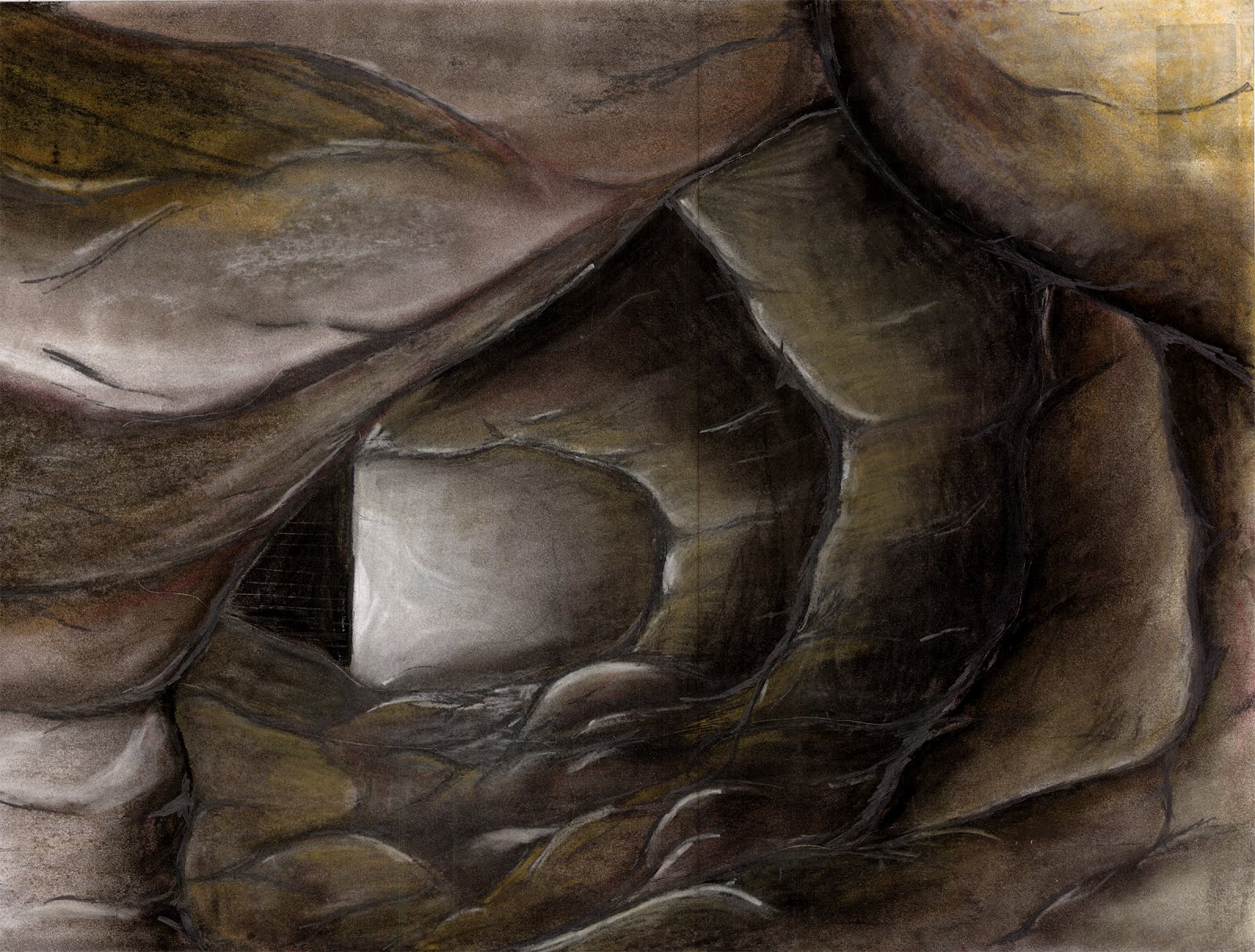
these last are the weakest of your images, simple views taken exactly from a model. each could|should be a drawing of its own, playing with light, graffiti, dirt and darkness. communicate the experience of the space you wish to provide.

beginnings of work

you are selling yourself short. these drawings are simply and ineffectively done. you can communicate in a more well articulated fashion, i have already seen it. think of the story that you are telling with your presentation : a set of design proposals along an untended railway. where are the proposals? how do they relate to one another spatially? programatically? where are the speculations as to how they will be constructed and how do they fit in with the existing context?

what are these details? what are they showing? why is nothing labeled? how does it fit into the project?
this is a drawing of an idea. ok, so how does it work? make yourself believe it through a drawing. make someone want to climb it. elevations. section details. how could these bricks be supported by fixings and the existing wall?


excavation

as digbeth is taken over and the graffiti is washed away from its surface, the area is redeveloped and its current inhabitants forced to leave, what kind of architectures could begin to exist beneath its surface?

also, this drawing, complete with speculations on construction, is really indicative of what youre thinking for this subversive architecture. really exciting explorations through excavations. space for new work to prosper as the explorers discover an archaeological past.

this section is really interesting, though could be more evocative and explanatory. scale? light? what is the space of the machines who dig versus the people who do? bring the people back into the architecture.

cannot wait to see where you take this project. really interesting and speculative.

there could be a duality between the sensuality of the images of color and the explanations of the line drawings. also, where is the graffiti you keep talking about? and the diggers? the people who reside there? can you build a model? bring back some of the carving techniques from last term?
great details showing time and process. i know this because youve told me. however, you need to explain this to any viewer. how can you communicate it within your portfolio?

drawing through an idea

curiosities about place. the rail line. the graffiti. the arches. the decay and the usage. where can research take a project. [also, this drawing needs to be labeled. no one knows what it means unless you tell them.]
anthropological histories, beneath the surface and above it. how does one design within that setting?
the drawing of ideas. what could be buried beneath the surface. a surface which is now being gentrified after a past of growth and industry. how would|could|should one explore it? what would those spaces be like? how would they expand through time?

contouring.

contour drawings can be fascinating as they are a way to illustrate the changing, physical world in a scientific way. this one is detailed because of its scale. this is actually covering a huge area, when you zoomed in, it wasnt as interesting. how do you develop your site with a similar level of detail?
the second drawing loses a lot of the clarity which was present in the map you found somewhere else. the precision is pretty important, especially when you are discussing the information about past|present|future rivers. is that condition of control precise or not so? consider that in your drawings.

the past|present|future of your site needs to be illustrated. change in topography. change in water level. is there a change in program and use through time as well?

the development of the site contours is actually quite interesting, especially when the two drawings are seen in the same manner and directly next to one another. you need a more exciting program to get this program off the ground. what would you like the site to be used for? really?

layers of information


in attempting to find relationships between different sets of data, the information can often become jumbled and difficult to understand. the labeling of the convoluted bits of drawing is increasingly necessary.

furthermore, how does one bring the beginnings of research into the design process, driving the assignment of space with curiosities and new discoveries?